Time: 12:00PM – 4:30PM
Location: Clear Creek Canyon just above MM261.5
Fish Landed: 24
Clear Creek 10/10/2013 Photo Album
Those of you reading this blog may accuse the author of fish count padding when you see Clear Creek and 24 fish landed, and yes the 24 fish landed were on the diminutive side. Admittedly landing 24 small fish in 4.5 hours of fishing gives the fish count table a boost, but I did not set out to do this, and besides it is my life and my day off so I can do whatever provides the most fun.
Since it was October 10 I was concerned that brown trout would begin their spawning ritual, and I’ve never had great success fishing in predominantly brown trout drainages during the spawning period. Before and after are generally spectacular, but during is another story. The weather was forecast to be transitional and I didn’t want to make another long trip after driving two hours to the Eagle River on Monday. In past Octobers I’ve fished the Big Thompson River and South Boulder Creek during this time period as both of these Front Range streams contain strong populations of rainbow trout, and they are spring spawners. Unfortunately the Big Thompson is out of consideration because of the huge September flood, and the Coal Creek Canyon road to South Boulder Creek below Gross Reservoir is also closed due to the flooding.
But wait a minute, there are alternative routes to South Boulder Creek. I went to Google maps and obtained driving directions and the web site sent me up the Boulder Turnpike to Boulder and then on Baseline Road to Flagstaff Drive, and that led over the mountain to Gross Reservoir. That sealed it. I packed all my fishing gear and made a lunch and departed on my way to South Boulder Creek. The high temperature for Thursday was expected to be low 60’s in Denver so that probably translated to a high in the 50’s at South Boulder Creek. That was certainly tolerable with the proper attire, but a front was expected to move in during the afternoon and that would likely yield showers starting at approximately 1PM.
I quickly reached Boulder and turned on to Baseline and reached the point where I needed to continue on Flagstaff, but there was a sign that said Flagstaff Drive was only open to residents. What should I do? My wife will tell anyone that listens that I am a chronic follower of rules, but for once in my life I ignored the sign and continued. After half a mile I reached a point where only one lane was open and there was a traffic signal alternating north and southbound vehicles through the single lane. This probably explains the sign about residents only. That was really the only dicey obstacle to my passage however and I continued on the winding twisty drive through the Flagstaff Mountain Park and then down the other side to Gross Reservoir. I had never been to Flagstaff Mountain Park, and it was a beautiful place with scenic views and numerous hiking trails, so it was a nice discovery for future exploration.
When I approached the reservoir I reached a point where I needed to turn left to continue on a dirt road to get to the parking lot below the dam that is the tralhead for the path that descends to South Boulder Creek. I made the turn and immediately I was stopped by a flag man. I was concerned that I would be reprimanded or fined for ignoring the sign that said residents only, so I began concocting a story to explain why I was on the road. I’d traveled ten miles beyond the residents only sign, so I was skeptical that this would be the case, but concerned nonetheless. Fortunately I waited for approximately 10 minutes and then I was allowed to proceed and after a mile or so I encountered the reason for the stoppage, a road grader working on smoothing out the dirt road.
I was relieved to discover that I was allowed to continue and after descending the steep dirt road with numerous switchbacks, I finally reached the destination parking lot and pulled in. There were no other cars and I looked down at the river far below and it looked ideal. The flows were 90 cfs on the department of water resources web site and this falls within the ideal range for the relatively small stream bed. I was ready to begin my preparation to fish when I looked at the entrance to the trail and spotted a yellow ribbon stretched across the south end of the parking lot so I walked over to inspect it more closely. The text on the opposite side of the ribbon said, “Do not cross sheriff’s line”. After the long drive through several obstacles I desperately wanted to duck under the ribbon and descend to the stream to fish, but I was in a disaster relief area and the obedient side of me prevailed and I decided not to ignore the sheriff’s line.
What now? I thought I remembered another road that connected with Colorado 119 that could get me to Nederland and then through Blackhawk and down to Idaho Springs where Clear Creek was open and available for fishing. Unfortunately I was out of cell range and the Colorado state map in the glove box was not detailed enough to shed any light on roads in the remote area I now occupied. I decided to reverse my course and once again was forced to wait while the flagmen stopped traffic for the road grader, but eventually I reached the paved road, and there was only one choice and that was to return to Boulder the way I had come. Once I got back in cell range in Boulder I asked my phone for driving directions to Idaho Springs and fortunately there was a route that took me south through Golden so I avoided returning to Denver on the Boulder Turnpike.
Since I was now ad-libbing I decided to drive up Clear Creek Canyon and check out water that I’d never fished. Route six winds through the canyon and signs along the route actually indicated that the entire canyon stretch is designated as a Jefferson County park. There were numerous pullouts along the way, but I continued along until I’d nearly reached the western end and pulled over in a stetch that appeared to have a lower gradient than much of the canyon water. I was just west of mile marker 261.5 as I ate my lunch in the car at noon. The temperature by now had climbed to the upper 50’s, but I could see large gray clouds moving in from the west, and I remembered the forecast of showers by 1PM so I wore my fleece and raincoat in addition to my ski hat for warmth.
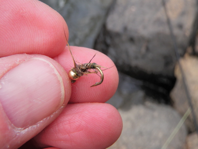
The Very Productive Hares Ear Nymph
After lunch I climbed into my waders and put together my rod and hiked down along the river a bit until I found a place where a rough path angled down the steep bank. I tied on a Chernobyl ant and added a beadhead hares ear nymph on a fairly long dropper and began to prospect the water. It didn’t take long before I hooked and landed two or three small brown trout on the hares ear, and this would be the norm for the remainder of the afternoon. The dark clouds moved in after a half hour or so and a light rain fell, but I was prepared with my raincoat so I continued fishing through the shower. Eventually the rain stopped and the sky brightened somewhat, but for the most part it was overcast and chilly during most of the afternoon.
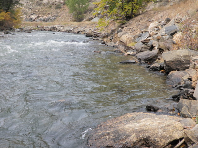
Typical Water That Yielded Fish Along Right Bank
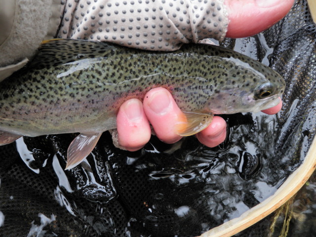
I continued fishing along the north bank of Clear Creek and hooked and landed fish at a nice pace. I fairly quickly learned that most of the fish were tight to the bank and eventually began to ignore all the water except the four to five feet along the edge. Several times I waded through small pockets tight to the bank where there was hardly any current and kicked out two or three nice fish by Clear Creek standards. Although the fish were mostly in the 7-9 inch range, I probably landed three or four in the 10-11 inch class, but also landed 10-15 fish that were below the 6 inch standard that I use to judge whether to count or not. In terms of flies, there was no strategy involved in this type of fishing. I stayed with the hares ear and Chernobyl over the entire afternoon and landed perhaps five or six on the Chernobyl with the remainder grabbing the hares ear as it drifted beneath the surface. There were also quite a few refusals to the Chernobyl ant and a number of fish chomped the foam attractor but came off when I set the hook aggressively causing the flies and fish to come hurtling back toward me through the air.
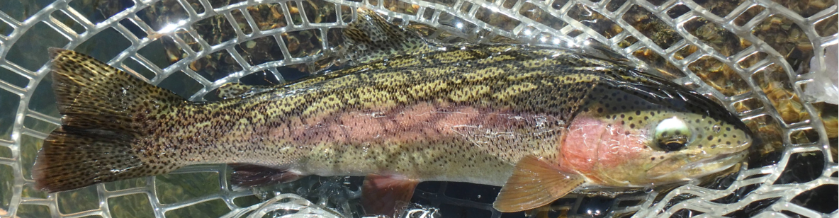
My Only Rainbow and the Largest Fish of the Day
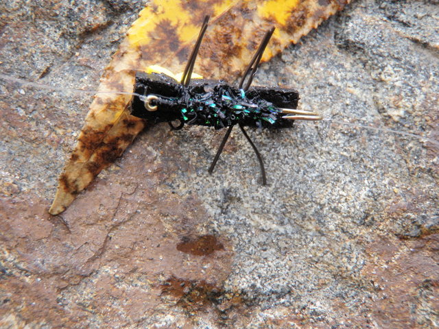
The Key Peacock Chenille Underbody
I covered perhaps a mile of stream over the course of four and a half hours of fishing and continuously kept on the move. I adhered to my rule of three casts and move for average water, one or two casts for marginal water and five casts for attractive water. Even though the fish were on the small side, I thoroughly enjoyed my afternoon on Clear Creek. I caught a bunch of fish, covered a lot of water, and explored a new stretch within an hour of my home in Denver. Nine more miles of stream remain along Clear Creek Canyon to be explored in future trips to this accessible area.
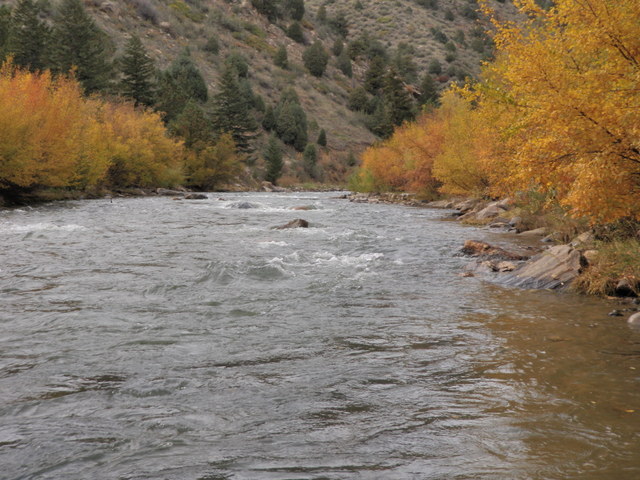
Nice Fall Foliage Remains Along the Creek